|
|
RiskChanges: a Spatial Decision Support System for analysing changing hydro-meteorological risk
C.J. van Westen (1), W.H. Bakker (1), V. Andrejchenko (2), K. Zhang (1), J. Berlin (3), I. Cristal (4) and R. Olyazadeh (5)
(1) University of Twente, Faculty ITC, Earth Systems Analysis, Enschede, Netherlands (c.j.vanwesten@utwente.nl)
(2) University of Salzburg, Department of Geoinformatics , Salzburg, Austria,
(3) Technical University of Delft, Delft, Netherlands
(4) Technical University of Dortmund, Faculty of Spatial Planning, Dortmund, Germany
(5) University of Lausanne, Switzerland
| Goto RickChanges |
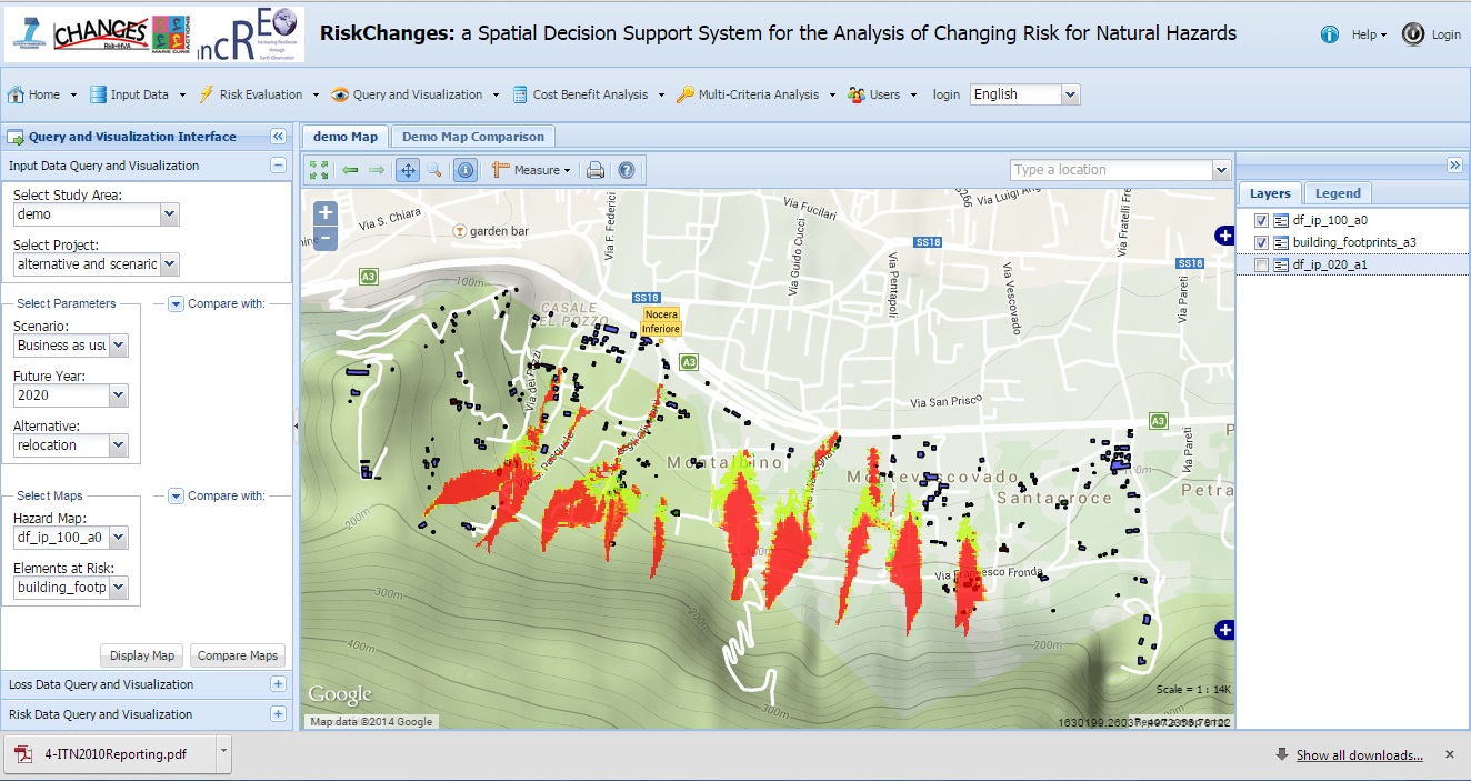
Within the framework of the EU FP7 Marie Curie Project CHANGES and the EU FP7 Copernicus project INCREO a spatial decision support system was developed with the aim to analyse the effect of risk reduction planning alternatives on reducing the risk now and in the future, and support decision makers in selecting the best alternatives. The Spatial Decision Support System is composed of a number of integrated components. The Risk Assessment component allows to carry out spatial risk analysis, with different degrees of complexity, ranging from simple exposure (overlay of hazard and assets maps) to quantitative analysis (using different hazard types, temporal scenarios and vulnerability curves) resulting into risk curves. The platform does not include a component to calculate hazard maps, and existing hazard maps are used as input data for the risk component. The second component of the SDSS is a risk reduction planning component, which forms the core of the platform. This component includes the definition of risk reduction alternatives (related to disaster response planning, risk reduction measures and spatial planning) and links back to the risk assessment module to calculate the new level of risk if the measure is implemented, and a cost-benefit (or cost-effectiveness/ Spatial Multi Criteria Evaluation) component to compare the alternatives and make decision on the optimal one. The third component of the SDSS is a temporal scenario component, which allows to define future scenarios in terms of climate change, land use change and population change, and the time periods for which these scenarios will be made. The component doesn’t generate these scenarios but uses input maps for the effect of the scenarios on the hazard and assets maps. The last component is a communication and visualization component, which can compare scenarios and alternatives, not only in the form of maps, but also in other forms (risk curves, tables, graphs)
Videos:
Data Input demonstration
Loss and risk assessment demonstration
Cost Benefit analysis demonstration
Multi-Criteria Evaluation demonstration
Visualisation Demonstration |
| User Guide |
| Technical Documentation |
| Tutorials |
|
|
|